
Usable Gaussian Splats for CAD Environment: A Complete Workflow with IGI, Bentley iTwin Capture Modeler Flex, and Terrasolid
Authors: Ana.Puttonen@terrasolid.com, Juuso.Siren@terrasolid.com, Mika.Salolahti@terrasolid.com, Marta.Kaczmarek@bentley.com, and k.wojcik@igi-systems.com
The geospatial industry is rapidly embracing new technologies that make 3D reality capture more realistic, efficient, and valuable than ever before. One of the most significant developments is the adoption of 3D Gaussian Splats, which provide highly detailed and photorealistic visualization while reducing many of the limitations of traditional mesh models.
A recent joint webinar hosted by experts from IGI Systems, Bentley Systems, and Terrasolid demonstrated how modern airborne imagery, advanced photogrammetric processing, and LiDAR classification can be combined into a single production workflow. Using a real-world project over the historic city of Tallinn, Estonia, the presenters showcased how high-quality imagery and LiDAR data can be transformed into accurate, georeferenced, and production-ready reality models.
High-Quality Data Acquisition Starts in the Air
Every successful reality modeling project begins with high-quality data acquisition. IGI Systems presented its modular airborne mapping solutions, highlighting the UrbanMapper 2 Evo camera system used for the Tallinn project.
The survey combined:
- Ultra-high-resolution nadir imagery
- Four oblique camera views
- Integrated LiDAR acquisition
- Accurate GNSS/INS positioning
- Flight management and sensor synchronization
The Tallinn project was flown at approximately 500 meters above ground level, producing imagery with a ground sampling distance (GSD) of 2 cm and LiDAR data with approximately 45 points per square meter.
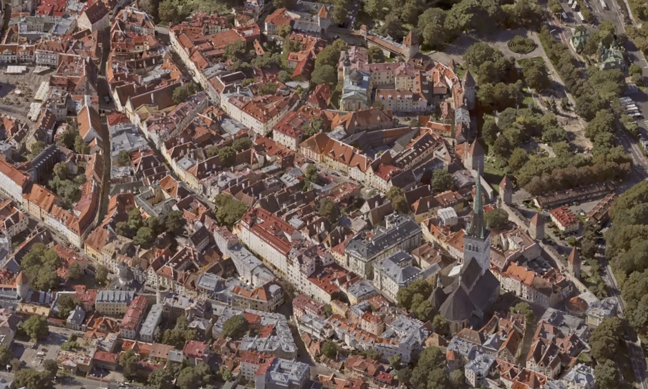
The example data set showcased how high-resolution aerial photographs can be transformed into highly detailed 3D Gaussian Splats, accurately reproducing complex urban environments, including historic buildings, streets, public spaces, and modern infrastructure.
One of the major advantages of the IGI platform is its modular architecture. Camera systems, LiDAR scanners, GNSS/INS units, mission planning, and sensor management are all tightly integrated, allowing operators to configure airborne systems for a wide variety of mapping missions.
Overcoming GPS Jamming with Advanced Navigation Technology
One particularly relevant topic discussed during the webinar was the growing challenge of GPS jamming and spoofing, especially across Eastern Europe.
IGI demonstrated how its latest navigation technology can continue producing usable trajectory data even when GNSS signals are partially disrupted.
An equally important aspect of the demonstration was the discussion of reliable image acquisition in challenging operational environments. Modern aerial mapping missions increasingly face the risk of GNSS (GPS) interference and jamming, particularly near airports, critical infrastructure, ports, and other sensitive areas. Such interference can affect positioning accuracy and, if not properly managed, reduce the quality of geospatial data products.
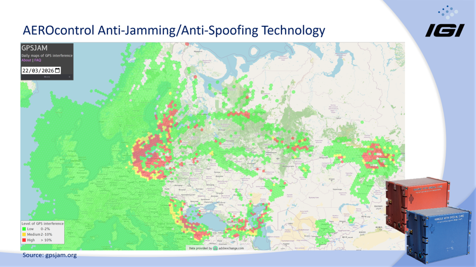
Instead of relying on a single satellite frequency, the system analyzes multiple GNSS frequencies and continues processing using signals that remain unaffected by interference. While direct georeferencing accuracy may decrease under severe jamming conditions, the resulting trajectories remain sufficiently accurate for aerial triangulation and LiDAR strip adjustment workflows.
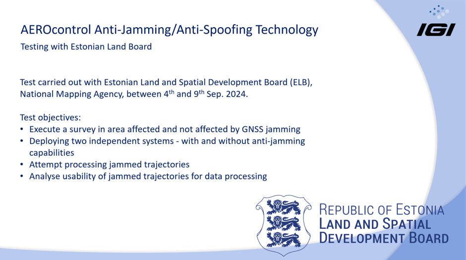
This technology was tested during extensive flights across Estonia, where both jammed and non-jammed areas were surveyed, demonstrating practical resilience under real operational conditions.
Motion Compensation for Sharper Images
Another innovation presented by IGI was Overlay Rotation Correction (ORC), a forward motion compensation technology.
During flight, aircraft motion naturally introduces blur into aerial imagery. ORC compensates by dynamically rotating the camera mount according to aircraft speed, altitude, and direction, significantly reducing image blur.
The results demonstrated:
- Sharper imagery
- Improved fine-detail preservation
- Better image matching during photogrammetric processing
- Higher-quality Gaussian Splats
For applications requiring centimeter-level accuracy, this improvement directly enhances the final reconstruction quality.
Processing City-Scale Projects with Bentley iTwin Capture Modeler Flex
Once imagery has been collected, the next challenge is processing thousands of high-resolution photographs into accurate 3D models.
Bentley Systems presented iTwin Capture Modeler Flex, designed specifically for large photogrammetric projects.
The software supports:
- Automatic aerial triangulation
- RTK and GNSS positioning
- Ground control points
- Camera calibration
- LiDAR integration
- Reality meshes
- Photogrammetric point clouds
- True orthophotos
- 3D Gaussian Splats
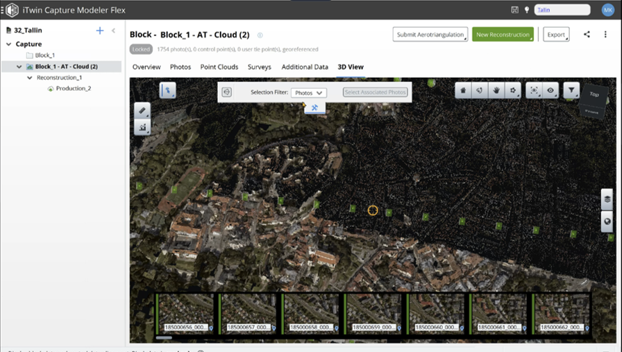
The Tallinn dataset consisted of approximately 1,700 aerial images, each roughly 300 MB in size.
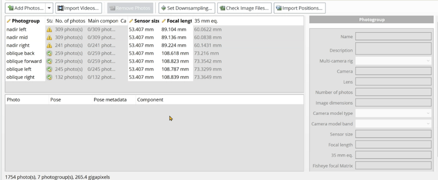
The complete workflow includes:
- Import aerial imagery.
- Import camera positions and orientations.
- Configure camera parameters.
- Perform aerial triangulation.
- Define reconstruction boundaries.
- Generate Gaussian Splats.
- Export to open formats such as PLY or 3D Tiles.
The software supports both local processing and Bentley Cloud processing, allowing users to balance hardware resources and project deadlines.
Cloud Computing Dramatically Reduces Processing Time
One of the most striking comparisons presented during the webinar involved processing performance.
For the Tallinn dataset:
- Medium-quality Gaussian Splats required approximately 18 hours using Bentley Cloud.
- The same dataset required approximately six days on a single high-end GPU workstation.
- At the highest quality settings, Bentley Cloud completed processing in approximately 2 days and 11 hours, while a local workstation required nearly 17 days.
For city-scale projects, cloud processing offers a significant productivity advantage, enabling organizations to deliver results much faster without investing in extensive local computing infrastructure.
Why Gaussian Splats Matter
Traditional reality meshes often struggle with:
- thin structures
- glass surfaces
- fences
- wires
- vegetation
- complex architectural details
Gaussian Splats preserve these features far more effectively, producing realistic visualizations that maintain fine geometry while remaining highly efficient for viewing.
During the webinar, examples from Tallinn’s Old Town demonstrated exceptionally detailed building facades, roof structures, railway infrastructure, and modern glass architecture.
The presenters emphasized that image coverage remains essential. Areas with insufficient photographic overlap will naturally produce lower-quality splats, making careful flight planning critical.
Terrasolid Brings Gaussian Splats into Production
Visualization alone is rarely enough for professional mapping projects.
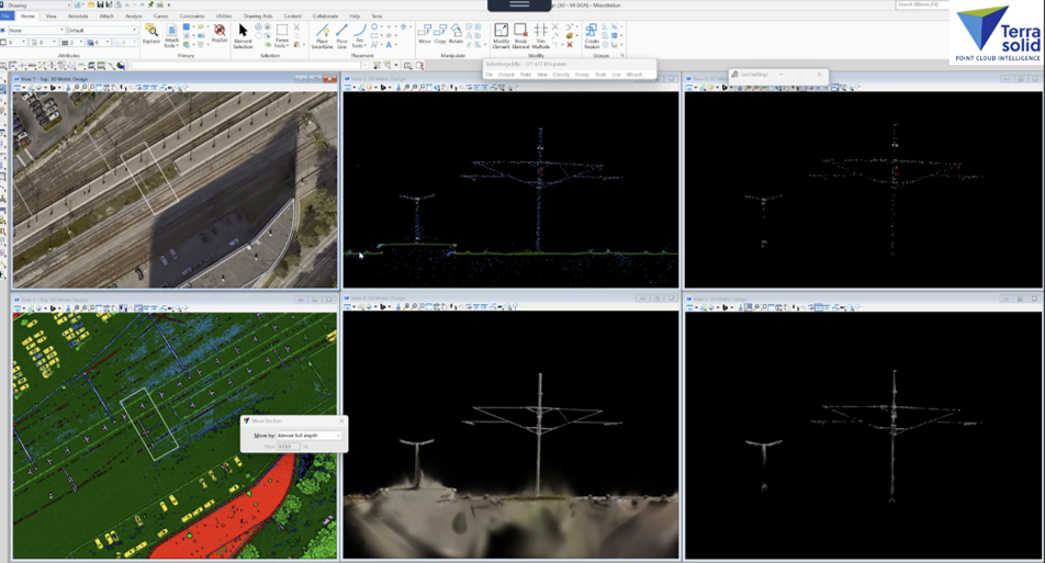
Terrasolid demonstrated how TerraSplat and TerraScan extend Gaussian Splats beyond visualization and into practical production workflows.
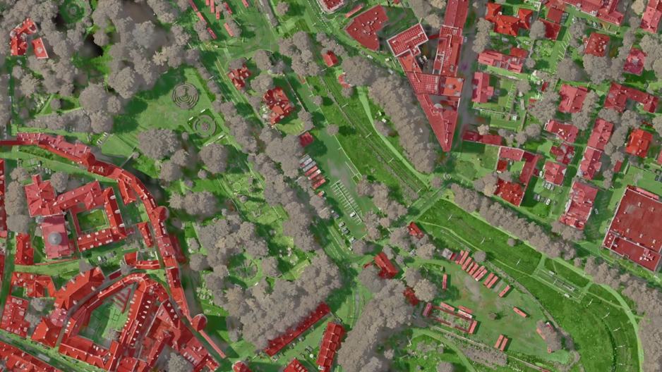
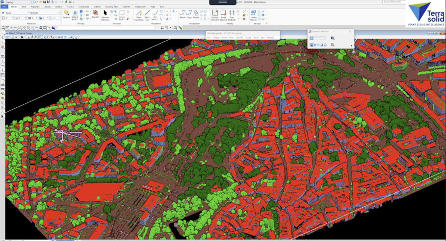
Instead of treating Gaussian Splats and LiDAR as separate datasets, Terrasolid merges both into a hybrid point cloud model.
This approach combines the strengths of each technology:
Gaussian Splats provide:
- photorealistic visualization
- facade detail
- object recognition
- improved interpretation
LiDAR provides:
- precise geometry
- reliable ground detection
- vegetation penetration
- established classification workflows
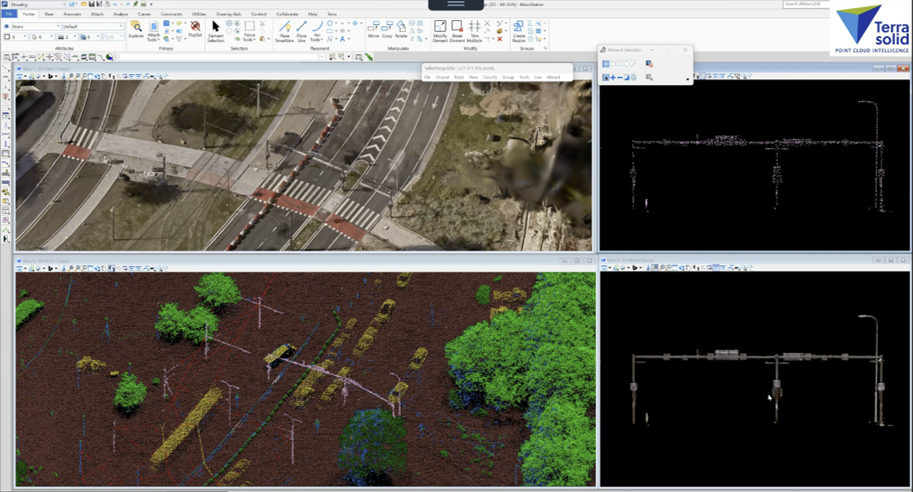
The result is a single dataset where LiDAR points inherit Gaussian Splat attributes while preserving accurate geometry.
This enables users to classify, analyze, and visualize both datasets simultaneously.
Hybrid Models Improve Classification
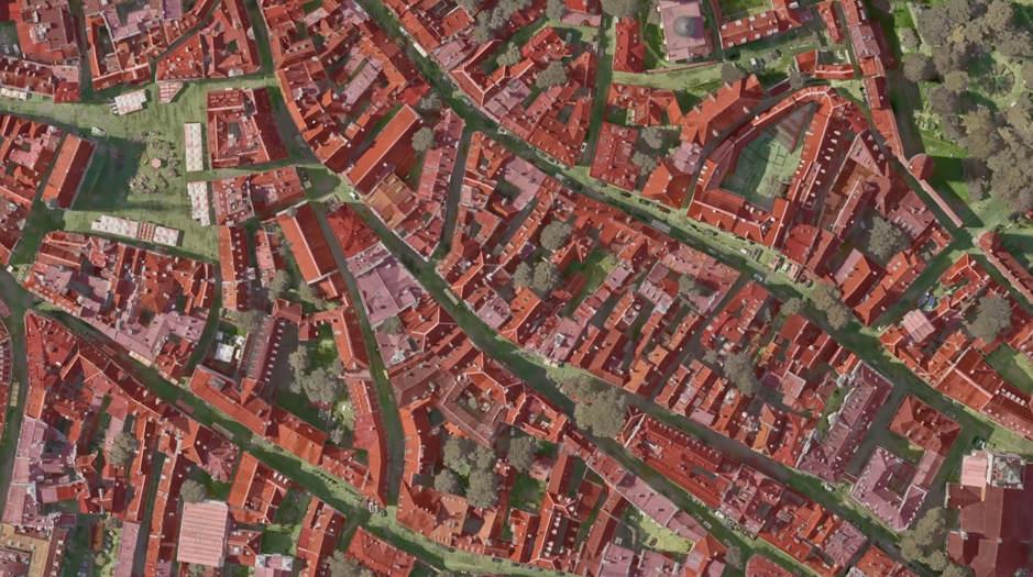
One challenge with photogrammetry alone is that dense vegetation often obscures the ground.
Conversely, LiDAR excels at ground detection but may contain gaps on vertical surfaces or fine objects.
By merging the two datasets, TerraScan enables:
- improved visualization
- better object interpretation
- enhanced quality control
- more intuitive manual editing
- preservation of LiDAR classification logic
The webinar demonstrated how poles, trees, buildings, and infrastructure become much easier to inspect when displayed as photorealistic splats linked directly to classified LiDAR points.
Looking Ahead – Outlook
The webinar clearly demonstrated that the future of reality capture is not about choosing between imagery and LiDAR. Instead, it is about combining their strengths into integrated workflows.
High-quality airborne imagery from IGI Systems provides the foundation. Bentley iTwin Capture Modeler Flex transforms that imagery into highly detailed Gaussian Splats. Terrasolid then combines these splats with LiDAR data for visualization, classification, and production.
The Tallinn case study illustrates how these technologies complement one another to create accurate, efficient, and scalable city-scale digital twins.
As Gaussian Splats continue to mature, hybrid reality models are likely to become a standard workflow for mapping professionals, surveyors, infrastructure managers, and digital twin developers seeking both visual realism and engineering-grade accuracy.
Conclusion
The future of reality capture lies not only in creating visually impressive models but in making those models usable throughout the engineering lifecycle.
With IGI’s aerial photogrammetry systems providing accurate image acquisition, Bentley Systems’ iTwin Capture Modeler Flex generating high-quality 3D Gaussian Splats, and TerraSplat integrating those splats into CAD environments, organizations gain a complete workflow that transforms aerial imagery into actionable engineering information.
By connecting reality capture, photogrammetry, and CAD, this integrated approach helps professionals build more informative digital twins, improve project collaboration, and make better decisions across the planning, design, construction, and maintenance phases of infrastructure projects.
Applications
This workflow is particularly valuable for:
- Transportation corridors
- Highway and railway projects
- Airports
- Utilities and energy infrastructure
- Urban planning
- Mining operations
- Industrial facilities
- Environmental monitoring
- Smart city initiatives
- Large-scale digital twin projects