

Utility mapping - Powerline processing software
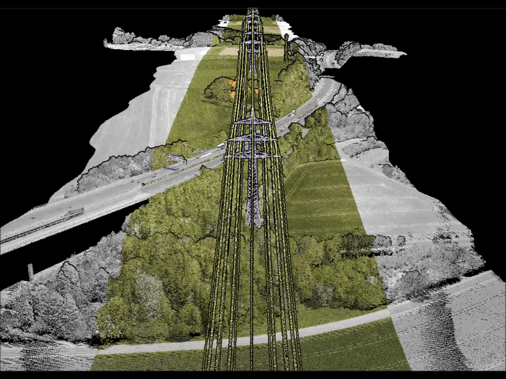
LiDAR is an the most efficient and reliable way of mapping powerlines and the surrounding terrain features, vegetation, building and other structures no matter the accessibility.
A complete power line analysis is achievable with Terrasolid software. Start with matching different flight lines, move to point cloud classification, which gives input for wires along with towers vectorization. This leads to clearance hazards identification. The vector data can be integrated into professional software and thus, used in performing thermal capacity studies, analysing rebuild/reconductor projects, and generating as-built records.
Improve risk management with a help of intelligent powerlines solutions to the common maintenance challenges!
Applications
Power line vectorization | Danger object detection | Danger objects labeling | Clearance under wires analysis | Automatic wires detection | Check and correction of wire attachments |Towers vectorization | Labelling towers and heights of catenaries | Vegetation mapping around powerlines | Clearance corridor management |Reports of danger object locations | Orthomosaic processing in corridor mapping | Powerline extraction from UAV data | Airborne data for power grid inspection | Transmission and distribution lines modelling | etc.
Powerline mapping solutions
Interested in mapping powerlines and the surrounding terrain features? Contact our sales with the form. We are happy to help and tell you more about our powerline mapping solutions.