

Unlock the Future of Urban Modeling with Our Cutting-Edge Software!
Transform your data into stunningly accurate 3D building and terrain models effortlessly. Whether you’re working with low-density data at just 1 point/m² or combining high-density airborne and mobile data, our software delivers unparalleled precision and detail.
Why Choose Us?
- Seamless Automation: Automatically generate comprehensive city models, complete with vectorized buildings, detailed terrain, and vibrant RGB color objects.
- Versatile Visualization: Drape images over terrain and use them as realistic textures for walls and roofs. Create breathtaking rendered images, immersive fly-through movies, or high-density point clouds with true-color values for each point.
- Effortless Integration: Quick export options make our models a perfect fit for Smart City and city planning applications across desktop, mobile, and web platforms.
Experience the Power of Point Cloud Intelligence! Elevate your projects with our state-of-the-art technology and see the difference in every detail.
Watch a video showing how to create content for your Digital Twin
Applications
Urban planning | Architectural and historical site documentation | Asset visualization and management | Emergency response, security and defense | Noise, flood, solar, shadow, visibility, lightning and wind analysis | Accident and catastrophe risk assessment | Virtual reality | Marketing | Visualization for communication of information to citizen | Radio-wave propagation | Fly-through animations | etc.
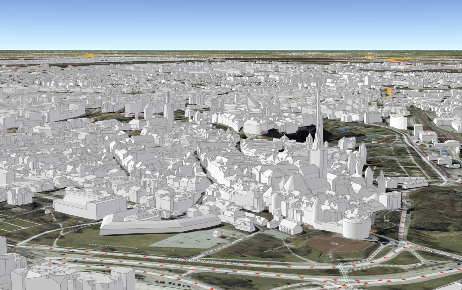
The first national 3D building model created using Terrasolid’s TerraScan released
The Estonian Land Board produced the countrywide 3D building dataset by combining laser scanning point cloud with 2D buildings data from Estonian Topographic Database (ETD). 3D representations of buildings, including roof structures (LOD 2) were created with TerraScan and later processed with tools provided by ArcGIS and FME. Attribute data was added to 3D building models by spatial joins to building footprints (ETD) and land parcels, resulting in rich set of semantic data (address, links to different national registries, etc.), as well as appropriate metadata. A perfect example of first steps in Digital Twin creation.
The 3D data can be viewed in application, hosted in ArcGIS Online https://3d.maaamet.ee/kaart/. The data is also available for download from Land Board’s Geoportal.
“As customers of Terrasolid we are very pleased with the capabilities of TerraScan, especially the accuracy of roof shapes of resulting 3D models of buildings. We are also looking forward to use TerraScan for capturing other features from lidar point cloud.” Hanno Kuus, Chief Specialist, Estonian Land Board
3D City solutions
Interested in building highly accurate 3D building and terrain models? Contact our sales with the form. We are happy to help and tell you more about our 3D city solutions.
Contact us
I am text block. Click edit button to change this text. Lorem ipsum dolor sit amet, consectetur adipiscing elit. Ut elit tellus, luctus nec ullamcorper mattis, pulvinar dapibus leo.
I am text block. Click edit button to change this text. Lorem ipsum dolor sit amet, consectetur adipiscing elit. Ut elit tellus, luctus nec ullamcorper mattis, pulvinar dapibus leo.
I am text block. Click edit button to change this text. Lorem ipsum dolor sit amet, consectetur adipiscing elit. Ut elit tellus, luctus nec ullamcorper mattis, pulvinar dapibus leo.
I am text block. Click edit button to change this text. Lorem ipsum dolor sit amet, consectetur adipiscing elit. Ut elit tellus, luctus nec ullamcorper mattis, pulvinar dapibus leo.
I am text block. Click edit button to change this text. Lorem ipsum dolor sit amet, consectetur adipiscing elit. Ut elit tellus, luctus nec ullamcorper mattis, pulvinar dapibus leo.
I am text block. Click edit button to change this text. Lorem ipsum dolor sit amet, consectetur adipiscing elit. Ut elit tellus, luctus nec ullamcorper mattis, pulvinar dapibus leo.
I am text block. Click edit button to change this text. Lorem ipsum dolor sit amet, consectetur adipiscing elit. Ut elit tellus, luctus nec ullamcorper mattis, pulvinar dapibus leo.
I am text block. Click edit button to change this text. Lorem ipsum dolor sit amet, consectetur adipiscing elit. Ut elit tellus, luctus nec ullamcorper mattis, pulvinar dapibus leo.
I am text block. Click edit button to change this text. Lorem ipsum dolor sit amet, consectetur adipiscing elit. Ut elit tellus, luctus nec ullamcorper mattis, pulvinar dapibus leo.
I am text block. Click edit button to change this text. Lorem ipsum dolor sit amet, consectetur adipiscing elit. Ut elit tellus, luctus nec ullamcorper mattis, pulvinar dapibus leo.
I am text block. Click edit button to change this text. Lorem ipsum dolor sit amet, consectetur adipiscing elit. Ut elit tellus, luctus nec ullamcorper mattis, pulvinar dapibus leo.
I am text block. Click edit button to change this text. Lorem ipsum dolor sit amet, consectetur adipiscing elit. Ut elit tellus, luctus nec ullamcorper mattis, pulvinar dapibus leo.