

TerraMatch
TerraMatch is a sophisticated tool for improving the accuracy and quality of the raw laser point cloud. It compares laser data from overlapping flight or drive paths and calculates correction values for the misalignment angles as well as xyz location errors. The comparison and correction value calculation can be either based on surface matching or on different types of tie lines. Tie line matching comprises points or lines on horizontal, vertical or sloped surfaces that can be used for matching flight/drive paths to each other, but also known point or line locations that enable the adjustment of the laser point cloud to control measurements.
TerraMatch is available in Full and UAV versions
Functionality matrix comparing TerraMatch and TerraMatch UAV – Click to open
Improving the accuracy and quality of the raw laser point cloud
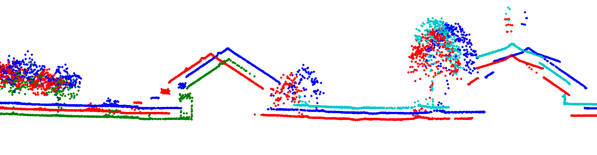
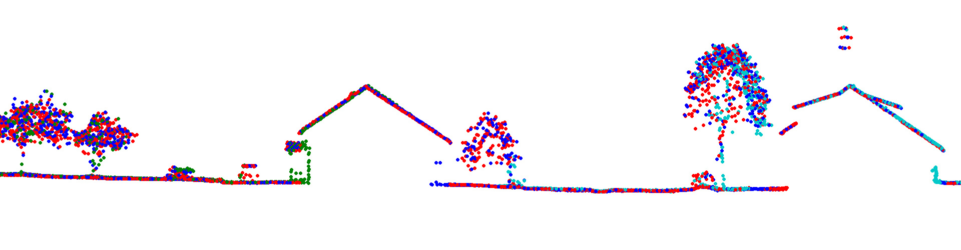
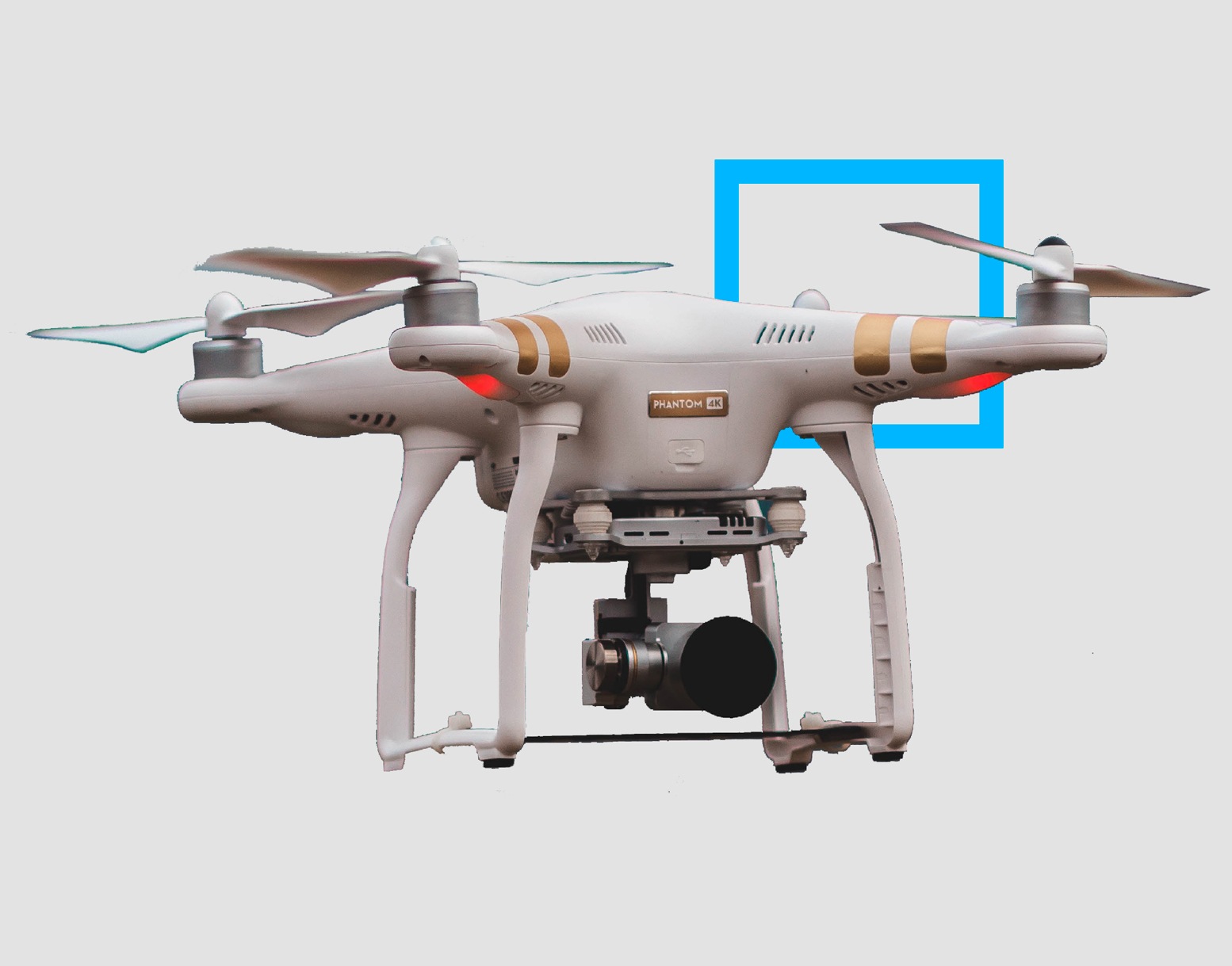
TerraMatch allows for strip adjustment of laser data from many different moving sensors, both airborne and mobile. Mobile laser scanning often requires more advanced processing and correction procedures as GNSS position quality fluctuates depending on varying access to satellite signals on ground. TerraMatch has specialized tools for fluctuating corrections based on control measurements and tie lines.
TerraMatch is also used for misalignment calibration. Misalignment should be calibrated regularly on all systems and can be checked and improved continuously by as a pre-step to strip adjustment and fluctuating correction in TerraMatch. If necessary, data may be collected on a specific calibration site which results in a point cloud dedicated for the calibration task. If the system includes several laser scanners, the calibration involves scanner-to-scanner matching.
TerraMatch can be used for fusing point clouds from different data sources. Airborne and mobile point clouds may overlap and TerraMatch offers tools for merging point clouds resulting in a seamless dataset for further usage.
The software has tools for exporting a number of statistical measures which can be used for accuracy evaluation and verification. There are also tools for visual evaluation helping the user to identify areas of poor positional accuracy or large mismatch.
TerraMatch must be accompanied by TerraScan
Applications
System calibration | Accuracy verification | Accuracy improvement | LiDAR | Mobile mapping | Personal laserscanning | Terrestrial laserscanning | Point cloud fusion | Georeferencing | Accuracy evaluation and reporting | etc.
Purchase
Purchase our products here. We have three different purchasing options for perpetual, subscription and academic licenses. Contact us for more information about different purchasing options.
Download
Download the software of your choice from our Software Download center. A license is needed for all of our software. You can familiarize with our pricing options in the Pricing section.
Technical description
You can read more about the specifications and technical description for each Terrasolid product here if you want to have a more comprehensive understanding of our individual products.
Discover
Even on a single PC you can profit from using TerraSlave. It processes TerraScan macros outside MicroStation, and thus, you are able to continue working with TerraScan without the need to wait until the macro execution has finished. TerraSlave is automatically installed with TerraScan on a single PC and a TerraSlave license is provided with each bought TerraScan license.
Get to know
I am text block. Click edit button to change this text. Lorem ipsum dolor sit amet, consectetur adipiscing elit. Ut elit tellus, luctus nec ullamcorper mattis, pulvinar dapibus leo. I am text block. Click edit button to change this text. Lorem ipsum dolor sit amet, consectetur adipiscing elit. Ut elit tellus, luctus nec ullamcorper mattis, pulvinar dapibus leo.
I am text block. Click edit button to change this text. Lorem ipsum dolor sit amet, consectetur adipiscing elit. Ut elit tellus, luctus nec ullamcorper mattis, pulvinar dapibus leo. I am text block. Click edit button to change this text. Lorem ipsum dolor sit amet, consectetur adipiscing elit. Ut elit tellus, luctus nec ullamcorper mattis, pulvinar dapibus leo.