

Push the limits of efficient Mining
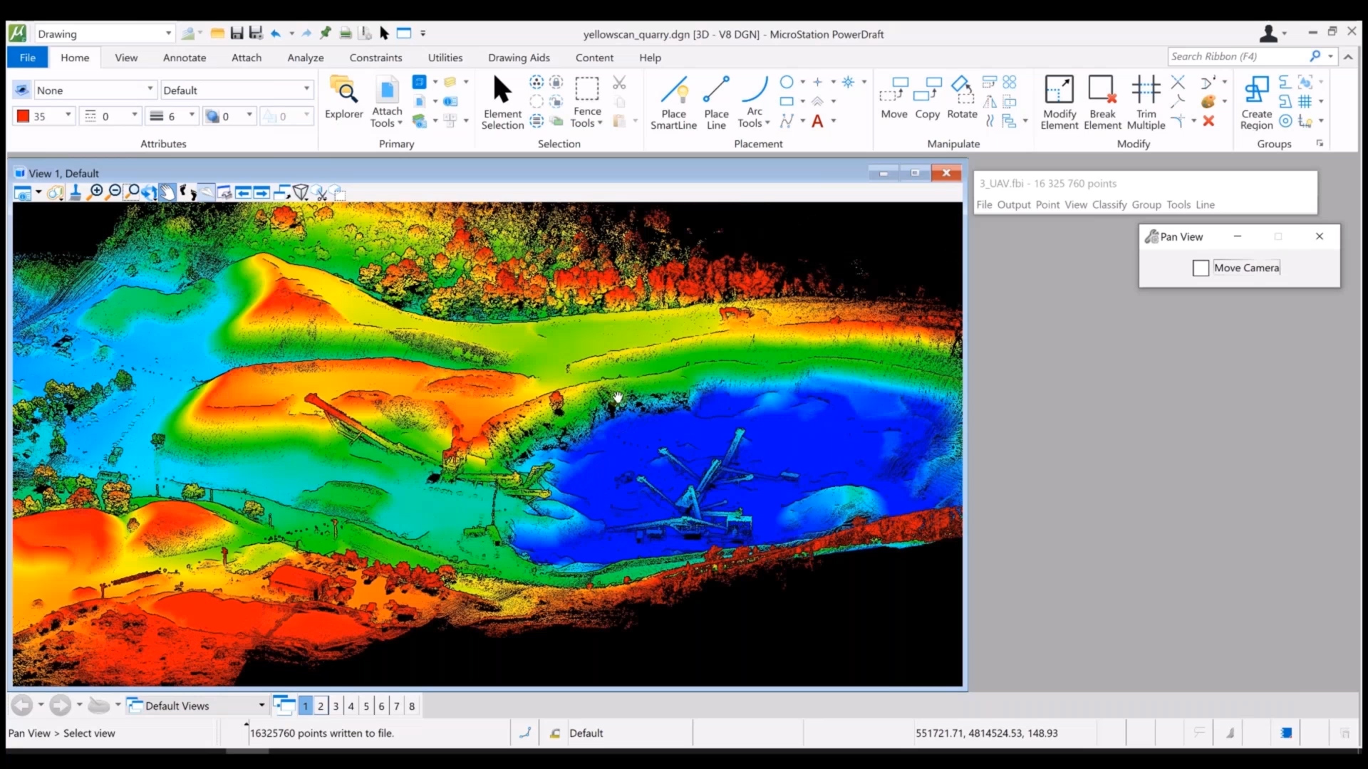
Civil, construction and mining engineering work require information of volumes and masses of soil. Airborne, mobile and unmanned laser scanning offer the fastest, safest and most accurate way of gathering geo-referenced 3D data under the least favorable conditions. Terrasolid helps you process the point cloud data, generate a DEM and calculate corresponding volumes and masses. By comparing surface models captured at different points of time, the erosion and accumulation (cut and fill) of material can be easily monitored and documented.
LiDAR requires no external light and the equipment is robust enough to cope difficult conditions e.g. underground. Static scanners are portable and mobile scanner can be mounted on any vehicle type. They produce a dense 3D point cloud with high speed. Modern positioning systems provide accurate and reliable positioning even during quite long GPS outages. Surveying railway or motorway tunnels can be conducted with mobile scanner without disrupting the traffic flow or placing personnel at risk in the middle of traffic.
Yet while constructing new underground spaces or maintaining the old ones, there are many applications that require accurate information of the precise dimensions of the tunnel: the thickness of the cement surface layer sprayed on the rock face must be monitored, structural discontinuities need to be evaluated and documented, rock mass and the surface analyzed, deformations and seepage must be kept eye on, as well as construction quality needs to be monitored.
Laser scanning produces a dense 3D point cloud depicting the surface of the tunnel walls as well as all objects inside the tunnel. Most scanners also provide intensity information for each point, thus giving information of the geological structure and the surface material of the wall. Additionally, in TerraMatch the intensity information can be utilized in combination with bright control signals for mobile scan line matching purposes. More data can be collected by taking accompanying visual-light-based camera images at the same time.
TerraModeler in mining
TerraModeler has tools for quantity computation. Those can be utilized to calculate and report the volume between two surfaces and/or based on tunnel or trench sections. Demo shows the volume calculation of stockpiles. watch the demo

Contours produced using TerraModeler
Contours produced using TerraModeler
Mining solutions
Interested in gathering the best possible geo-referenced 3D data? Contact our sales with the form. We are happy to help and tell you more about our mining solutions.