

TerraModeler User Guide
Update Regions
Not Lite, Not UAV
 Update Regions tool redraws the regions in the CAD file. If new region definitions were created or existing regions were updated, the tool draws all display elements into the CAD file that are defined for a region. This includes a center marker, a so-called solution shape, and optionally a color-filled shape, area pattern, and a title.
A region is displayed by the center marker and the solution shape. The additional elements drawn for a region depend on the region type and are defined in Regions / Region types category of the TerraModeler Settings. The title format and content are defined in Regions / Title formats category of the TerraModeler Settings.
The different region elements can be drawn on several CAD file levels which supports their modification with CAD tools. The levels are defined in Regions / Region levels category of the TerraModeler Settings.
To redraw regions:
1. Select the Update Regions tool.
The Update Regions dialog opens:
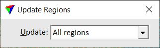
2. Select in the Update list what is updated: All regions or regions in the current View contents only.
3. Click inside a top view.
The update starts and regions are redrawn.
If a region can not be drawn, an error message is displayed. This can be caused, for example if region boundaries are not closed or if they are deleted. There are some tolerances related to gaps in the boundary line network which are defined in Regions / Region design category of the TerraModeler Settings.