

TerraModeler User Guide
Managing Surfaces
TerraModeler supports theoretically an unlimited number of surfaces during the same session. In practice, the performance of the software and the ability to create, process, and display surface models depends on the size of the models and the amount of RAM available on the computer.
The Surfaces tool opens a window that contains a list of surfaces that are currently loaded into TerraModeler.
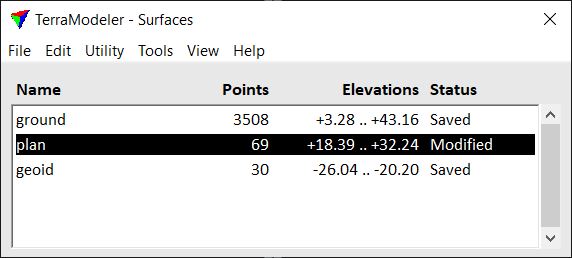
The list of loaded surfaces in the Surfaces window shows information about each surface. The information that can be displayed includes surface attributes, storage information, and status information. The file Status determines, whether a surface model has been modified (Status = Modified), saved (Status = Saved) or opened as a reference surface (Status = Reference).
The window’s menu provides commands for managing the surfaces, such as open, save, rename and close a surface, view surface statistics, modify the triangles of a surface, import and export data, etc. Further, there are options to derive new surfaces by applying calculations to existing surface models. The menu also contains commands for opening all toolbars that are part of the TerraModeler toolbox.
There are three methods included in the Surfaces window that produce surface representation files in batch processes:
•Produce contours - creates contour CAD files that can store contour lines, labels and ticks.
•Produce lattice models - creates lattice text files that store a gridded DEM of format XYZ.
•Produce triangles - creates triangle CAD files that store the triangle shapes.
The batch processes can include data from several sources, such as point cloud data from TerraScan projects, survey elements from TerraSurvey or other applications, and breaklines filtered by breakline rules.