

TerraScan User Guide
Measure Point Density
 Measure Point Density tool displays the average number points per squared master unit. You can measure the point density in a rectangular or circular area, inside selected polygons, or from the whole data set. The measurement can be based on points loaded into TerraScan or points residing in the active project.
The point density values are displayed in the information bar at the bottom of the CAD platform interface. The values include the amount of points per sample area and the average point density.
If the point density is measured in selected polygons, the tool places a text element inside each polygon. The text element shows the point density. It is drawn with the active symbology and text settings of the CAD file.
To measure the point density from all loaded points:
1. Select the Measure Point Density tool.
This opens the Measure Point Density dialog:
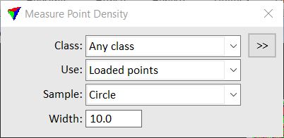
2. Define settings.
3. If Sample is set to All points or Selected polygons, place a data click anywhere in a CAD file view (Loaded points) or inside the project area (Project points).
This displays the average point density of loaded points or points in the project.
OR
4. If Sample is set to Rectangle or Circle, define the center point of the sample area with a data click.
This displays the average point density inside the sample area.
SETTING |
EFFECT |
|---|---|
Class |
The point density is computed for points of any class or of a specific class. The list contains the active class definitions in TerraScan. |
|
Opens the Select classes dialog which contains the list of active classes in TerraScan. You can select multiple source classes from the list that are then used in the Class field. |
Use |
Defines which points are used for the density measurement: •Loaded points - density is measured from points loaded in TerraScan. •Project points - density is measured from binary files referenced by the active project in TerraScan. Not UAV |
Sample |
Sample area for the density measurement: •All points - area covered by all points. •Rectangle - rectangular area. •Circle - circular area. •Selected polygons - one or more selected shape elements. |
Width |
Defines the width of a Rectangle or the diameter of a Circle depending on the setting in the Sample field. Given in master units of the CAD file. |
Decimals |
Number of decimals for labeling the point density inside polygons. This is active only if Sample is set to Selected polygons. |
