

TerraScan User Guide
Show Street View
 Show Street View tool opens a Google Street View© image in a browser. The Street View© image is determined by a mouse click. This requires that the projection system of the data set is selected in the tool's dialog.
The Street View images category of TerraScan Settings defines display settings for the images in the browser, as well as a key for accessing Street View© images. The access key can be changed to a company's own key, if necessary.
To show a Street View image:
1. Select the Show Street View tool.
This opens the Show Street View dialog:
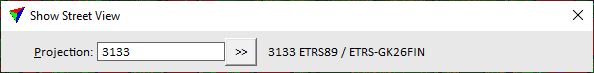
2. Select the correct projection system.
3. Place a data click inside a top view in order to determine the viewer location.
4. Place another data click inside the top view in order to determine the viewing direction and the target location.
The standard browser opens the Google Street View© image that is closest to the viewer location and looks in the direction of the target location.
SETTING |
EFFECT |
|---|---|
Projection |
Projection system of the data set. Click on the >> Button to open the Browse for Projection System dialog. The dialog provides a search option for projection systems as well as a list of all implemented systems. In addition, any user-defined projection systems are included in the list. |