

TerraModeler User Guide
Display Raster Triangles
Not Lite
 Display Raster Triangles tool displays triangles in a manner suitable for rendered images. The triangles are used by TerraPhoto in order to drape images on a surface model in rendered views. The images have to be attached as raster references in TerraPhoto.
The raster triangles are not drawn permanently into the CAD file and they remain linked to the surface model. This allows TerraModeler to update the display after modifications and to erase the display using the Erase Display tool.
To display raster triangles:
1. Select the Display Raster Triangles tool.
This opens the Display Raster Triangles dialog:
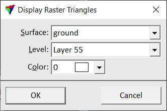
2. Define settings and click OK.
This displays the triangles. You can now use TerraPhoto tools to create rendered views.
Setting |
Effect |
|---|---|
Surface |
Name of the effected surface model. |
Level |
Name of the level in the CAD file on which the raster triangles are drawn. |
Color |
Color used to draw the raster triangles. Uses the active CAD file color table. |