

TerraModeler User Guide
Display Region Triangles
Not Lite, Not UAV
 Display Region Triangles tool displays the triangles of a surface model. The triangles are colored by regions which are defined by closed shape elements. The triangles and the parts of triangles falling inside each region are drawn using the color of the boundary shape. The tool may be used to visualize, for example, land use regions, soil type regions or property boundaries.
Display Region Triangles tool creates CAD file elements which are not linked to a surface model. Thus, TerraModeler is not able to update or erase elements created by this tool.
To display region triangles:
1. Select region boundary shapes.
2. Select the Display Region Triangles tool.
This opens the Display Region Triangles dialog:
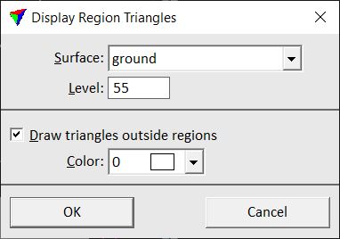
3. Define settings and click OK.
This writes triangles colored by region into the CAD file.
Setting |
Effect |
|---|---|
Surface |
Name of the effected surface model. |
Level |
Number of the level in the CAD file on which region triangles are drawn. |
Draw triangles outside regions |
If on, triangles which are outside all selected boundary shapes are drawn using the given Color. |