

TerraPhoto User Guide
Save Rendered View
 Save Rendered View tool saves a rendered view into an image file. The view must be open in order to save it.
The tool can be used to create GeoTagged TIFF files. The GeoTag contains the latitude and longitude coordinates of the view that is saved. If the view is a orthographic view, the coordinates of the view’s center point are stored. If the view is a perspective view, the coordinates of the camera location are stored. The GeoTagged TIFF files can then be combined in another software into a .KMZ package for being displayed in Google Earth, for example.
For more information about rendering in TerraPhoto, see Section Rendered Views. Some settings for rendered views can be defined by the Define Rendering Settings tool.
To save a rendered view:
1. Select Save Rendered View tool.
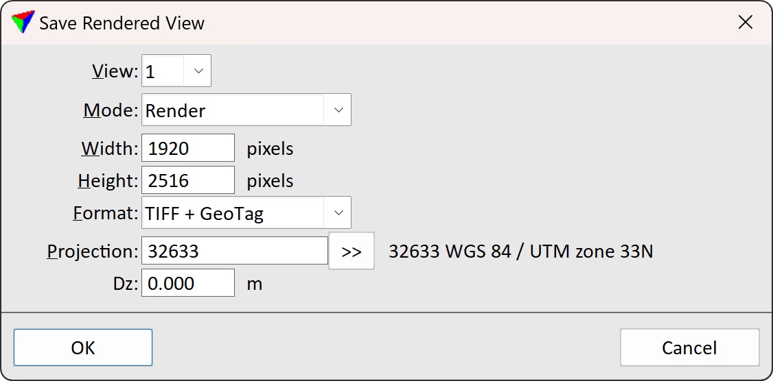
This opens the Save Rendered View dialog:
2. Define settings and click OK.
This opens the Rendered view raster file dialog, a standard dialog for saving files.
3. Define a directory and a file name for storing the image.
4. Click Save to save the image.
SETTING |
EFFECT |
|---|---|
View |
Defines the CAD file view which is saved into an image. |
Mode |
Defines the mode for capturing an image of the view: •Render - TerraPhoto rendering is applied to the view. This excludes text elements from the captured image. •Capture - a screen capture is created of the view. This includes text elements. |
Width |
Width of the image in pixels. The default value is the view width when the tool is started. |
Height |
Height of the image in pixels. The default value is the view height when the tool is started. |
Format |
Format of the stored image. Supported formats are BMP, ECW, JPEG, and TIFF + GeoTag. |
Ratio |
Compression ratio for ECW images. This is only active if Format is set to ECW. |
Projection |
Projection system that is used to write the GeoTag information for a TIFF image. Projection systems are defined by their EPSG code. See more information about projection system definition in Coordinate transformations / Transformations. The list contains also projection systems that are active in Coordinate transformations / User projection systems of TerraPhoto Settings. This is only active if Format is set to TIFF + GeoTag. |
Dz |
GeoTag elevation offset. Elevation shift to apply from true view position. |