

TerraScan User Guide
Show statistics
Not UAV
Show statistics command calculates simple statistics for the block binary files. The output dialog includes information about classes, point count as well as minimum, maximum, and median elevation values. Besides for the whole project, these values are also calculated for each block and line. The statistics can be saved into a text file.
To calculate statistics for a project:
1. Select Show statistics command from Tools pulldown menu.
The calculation process starts and an information window is displayed that shows the progress of the process. After finishing the calculation, the Project statistics dialog opens:
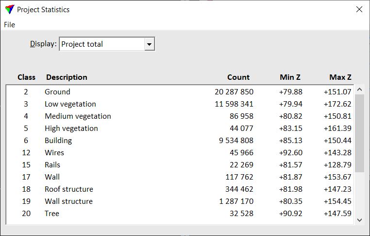
Check the statistics for the project, different blocks, or lines by selecting the corresponding settings in the Display and Block or Line lists.
The statistical values for all classes occurring in the block binary files are listed in the lower part of the dialog.
You can save the statistics into a text file using Save as command from the File menu in the Project statistics dialog.
The text file stores the point count for each class and the elevation values if Display is set to Project total, and the point count for each class per block or line if Display is set to By block or By line.
SETTING |
EFFECT |
|---|---|
Display |
Content of statistics display: •Project total - values for the whole project are displayed. •By block - values are shown for the selected block. •By line - values are shown for the selected line. |
Block |
Name of the block for which statistical values are shown. This is active only if Display is set to By block. |
Line |
Number of the line for which statistical values are shown. This is active only if Display is set to By line. |