TerraScan User Guide
Show statistics
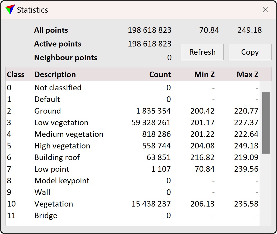
Show statistics command displays basic statistics information about laser points. In the upper part of the Statistics window, the amount of all points, active points and neighbour points are listed, as well as the elevation range for all points. In the lower part, the separate classes are listed with the point count, minimum elevation and maximum elevation values for each class.
The Refresh button updates the statistics shown in the dialog with changes done in the loaded points. A dialog does not update automatically when classifying, adding, or removing points.
The Copy button copies the statistics to the clipboard as text. This is useful for project documentation.