

TerraModeler User Guide
Viewing surface statistics
 You just created your first surface model with TerraModeler. The model exists in two types of memory. It has been saved to a binary file on the hard disk for permanent storage. When you work with TerraModeler, the surface model is also loaded in the RAM of your computer.
You can use the Surfaces tool to view information about loaded surfaces.
To view surface statistics:
1. Select Surfaces tool from the General toolbox.
The Surfaces window opens showing a list of loaded surfaces. Select surface model Ground, if it is not selected already.
2. Select View statistics from the Utility menu.
The Surface statistics dialog opens:
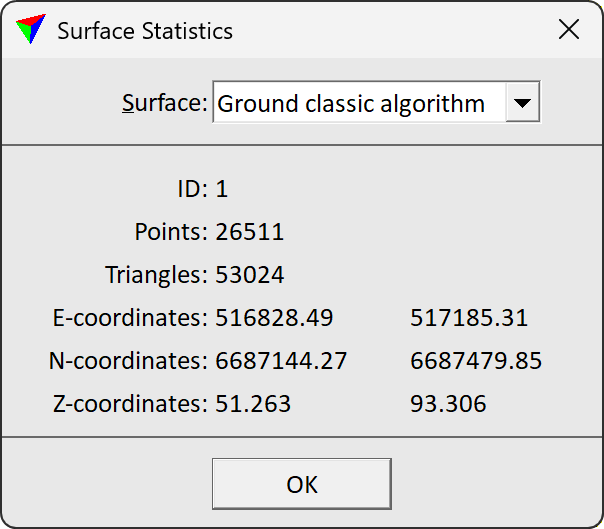
The dialog shows the internal ID of the surface model, the number of points and triangles, and the ranges of easting, northing, and elevation coordinates.
3. Click OK after reviewing the statistics.