

TerraModeler User Guide
Placing elements on surface elevation
 A surface model can be used as a design aid. TerraModeler makes it easy to place elements at the elevation of a surface. You may use this capability, for example, to place items such as manholes, trees, or shrubs on the ground elevation.
To place elements on surface elevation:
1. Select View Elevation tool from the Draw toolbox.
The View elevation dialog opens:
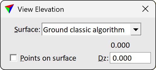
As you move the mouse, the dialog dynamically displays the elevation value of the selected Surface at the mouse pointer position.
2. Set Points on surface lock on.
3. Start drawing an element using any MicroStation tool for drawing elements. Feel free to experiment with by drawing some lines, shapes, or placing a few cells.
The elements are drawn as 3D elements using the elevation value from the Ground surface.
When Points on surface lock is on, TerraModeler calculates the elevation for all data points entered in a top view inside the surface area. Therefore, be sure to turn the lock off if you do not want to use it any longer.