

TerraModeler User Guide
Triangulate Multiple Sources
 Triangulate Multiple Sources tool creates a new surface model from breakline elements and/or point cloud data in one operation. The surface model can be created as:
•Normal model - the model can not be rebuild when the source data has been changed.
•Rebuildable model - the surface model can be rebuild after the source data has been changed by using the Rebuild Models tool.
•Editable model - the surface model is updated if there are modifications of the laser points used in the model. This requires the usage of points loaded in TerraScan.
The breaklines can be defined as vector elements filtered by rules. See Filtering rules for more information about rule files and how to create them. Alternatively, breaklines can be derived from survey elements created by TerraSurvey or other applications enabled in Triangulate Survey category of the TerraModeler Settings.
Point cloud data can be used from points loaded in TerraScan or directly from a TerraScan binary file stored on a hard disk.
To create a surface model from multiple sources:
1. Select the Triangulate Multiple Sources tool.
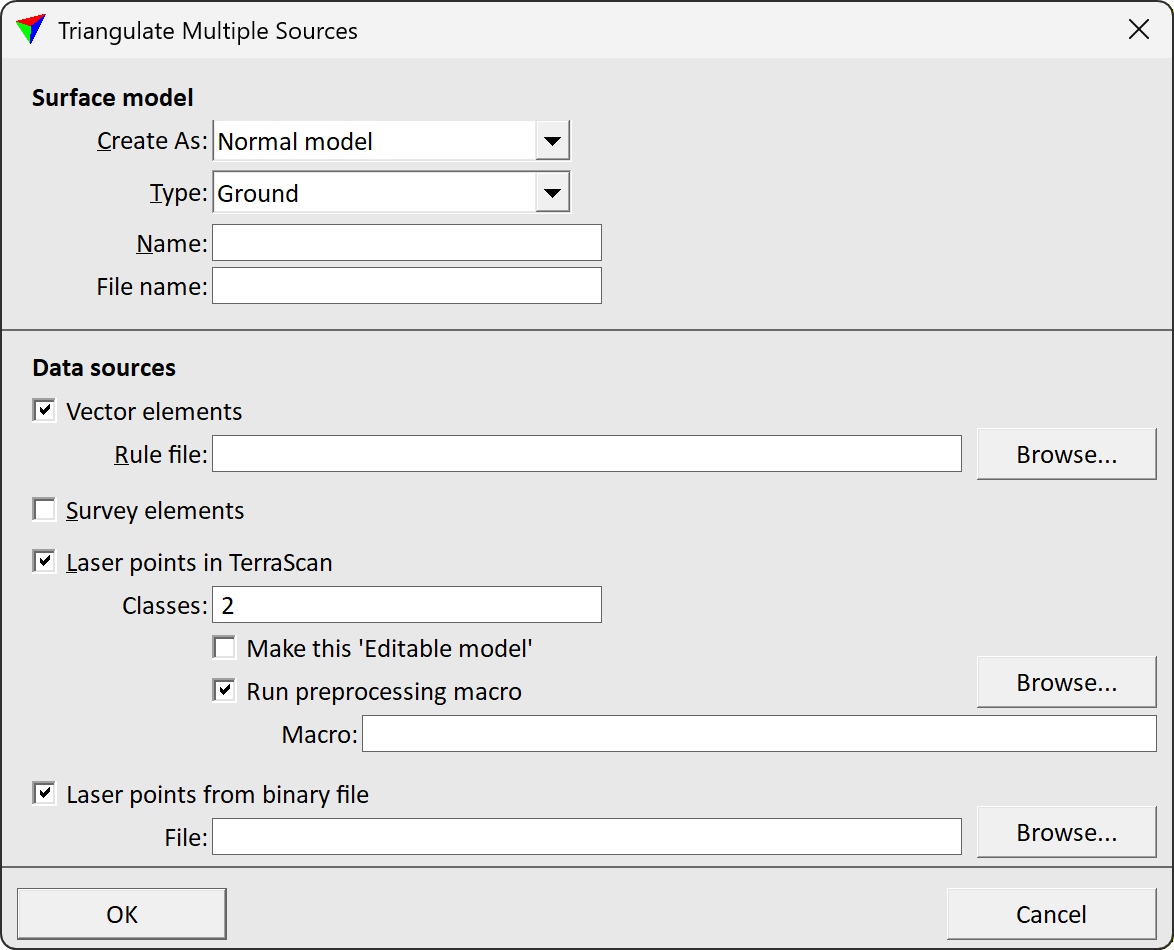
This opens the Triangulate Multiple Sources dialog:
2. Define settings for the surface model creation.
3. Select data sources and define settings.
4. Click OK.
This opens the Triangulate surface dialog. Follow the common steps for Creating a surface model.
Setting |
Effect |
|---|---|
Create As |
Defines surface model rebuild options: •Normal model - the model can not be rebuild. •Rebuildable model - the model can be rebuild after changes to the source data using the Rebuild Models tool. |
Type |
Surface model type. |
Name |
Name of the new surface model. |
File name |
Name of the surface model file stored on the hard disk. |
Vector elements |
If on, breaklines are included in the model. The breaklines are defined by vector elements and the given Rule file. |
Survey elements |
If on, breaklines are included in the model. The breaklines are defined by TerraSurvey or any other application enabled in TerraModeler Settings. |
Laser points in TerraScan |
If on, laser points loaded in TerraScan are included in the model. Only points of the given Classes are included. |
Make this ‘Editable model’ |
If on, the model created from the laser points is updated if the point class changes. Only active if Laser points in TerraScan is switched on. |
Run preprocessing macro |
If on, the given TerraScan Macro is applied to the loaded points before the surface model is created. Only active if Laser points in TerraScan is switched on. |
Laser points from binary file |
If on, laser points from the given TerraScan binary File stored on a hard disk are included in the model. |