

TerraScan User Guide
Draw from points
Draw from points command draws an approximate survey path as a linear element into the CAD file. This works if the laser points are in the original scan order as the command deduces the path from laser points only.
To draw an approximate flight path:
1. Choose Draw from points command from the Line menu.
This opens the Draw Flight Lines dialog:
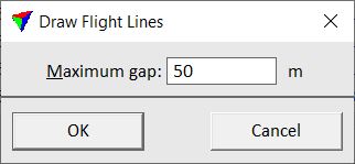
2. Define a Maximum gap value and click OK.
This computes the approximate survey path(s) and draws one or several linear elements into the CAD file. The line elements are drawn on the active level using the active symbology settings of the CAD file.
SETTING |
EFFECT |
|---|---|
Maximum gap |
A new line element starts if the distance between two consecutive laser points exceeds this value. |