TerraScan User Guide
New Drone Project
Not Lite
 New Drone Project command imports data that has been collected with UAV-mounted systems and pre-processed with system-specific software. The input data includes the LiDAR point cloud in LAS format and trajectory information. The import wizard performs the following steps:
•Creates a CAD file if not open already
•Fixes coordinate setup to match incoming points
•Reads laser points into memory applying a coordinate transformation
•(Optional) Sort points by xy location for speed improvement
•Classifies all points to class 1 – Default
•(Optional) Adjusts elevation values from ellipsoidal to orthometric
•(Optional) Creates a default list of point classes
•Fixes the scan direction bit
•Creates a folder and reads a trajectory solutions applying a coordinate transformation
•(Optional) Adjusts trajectory elevation values from ellipsoidal to orthometric
•Deduces line numbers for laser points
The import of input data may be system-specific. System selection optimizes certain parameters, such as level of smoothing, in processing phase according to system characteristics.
To create a new project for UAV point clouds:
1. Select New Drone Project command from the Wizard menu.
This opens the New Drone Project dialog:
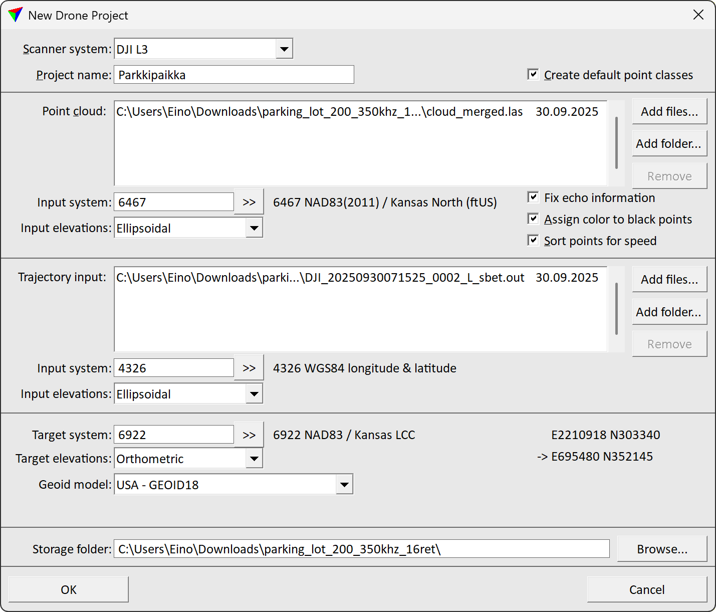
2. Define settings and click OK.
SETTING |
EFFECT |
||
|---|---|---|---|
Scanner system |
System used to collect or generate the point cloud data:
|
||
Project name |
Name of the new project. |
||
Create default point classes |
If on, the default class file is copied from the TerraScan installation folder to the project directory. |
||
Point cloud |
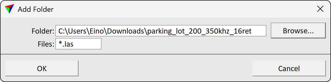
Raw point cloud data provided by the system-specific software. Click on the Add files... button in order to select the input file(s) in a standard dialog. The expected format of the point cloud file is LAS. To quickly select multiple point cloud files from a parent folder click Add folder... button. This opens Add folder dialog. Define the parent folder in Folder field and file search term in Files field. An example search term *.las would select all files whose filenames end with ".las".
|
||
Input system |
Projection system of the input point cloud data. Click on the |
||
Input elevations |
Elevation values of the input point cloud data: Ellipsoidal or Orthometric. Data collect with measurement systems is usually provided with ellipsoidal height values. |
||
Remove duplicate points |
If on, point duplicates are removed. |
||
Fix echo information |
If on, echo numbering is recalculated during import. This option is available only for DJI L3 system. |
||
Assign color to black points |
If on, color of fully black points is replaced with intensity based greyscale color. |
||
Sort points for speed |
If on, points are sorted by XY coordinates. This speeds up processes that rely on neighborhood relationships between points. |
||
Trajectory input |
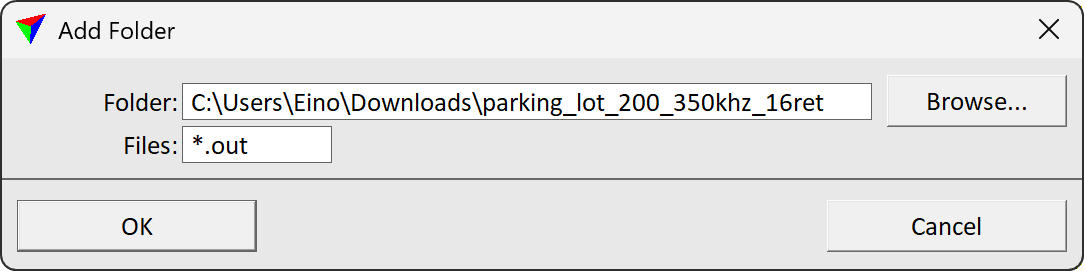
Raw trajectory data provided by the system-specific software. Click on the Add button in order to select the input files in a standard dialog. The expected format of the trajectory information is SBET.OUT for the DJI L1 system. If a related accuracy file SMRMSG.OUT is available, TerraScan reads the information from both files. To quickly select multiple trajectory files from a parent folder click Add folder... button. This opens Add folder dialog. Define the parent folder in Folder field and file search term in Files field. An example search term *.out would select all files which filename ends with ".out".
|
||
Input system |
Projection system of the input trajectory data. Click on the >> Button to open the Browse for Projection System dialog. The dialog provides a search option for projection systems as well as a list of all implemented systems. In addition, any user-defined projection systems are included in the list. |
||
Input elevations |
Elevation values of the input trajectory data: Ellipsoidal or Orthometric. Data collect with measurement systems is usually provided with ellipsoidal height values. |
||
Target system |
Projection system of the data for processing. Click on the >> Button to open the Browse for Projection System dialog. The dialog provides a search option for projection systems as well as a list of all implemented systems. In addition, any user-defined projection systems are included in the list. |
||
Target elevations |
Elevation values of the data for processing: Ellipsoidal or Orthometric. Data for delivery is usually provided with orthometric values of some local height model. |
||
Geoid model |
Model that provides the geoid correction. Transforms the elevation values of the input data from input to target elevation values. This is active only if any Input elevations setting differs from the Target elevations setting. |
||
Survey date |
Date when the data was captured. The format is day/month/year (dd/mm/yyyy). This is relevant for the conversion of time stamps when importing point cloud and trajectory data. |
||
Storage folder |
Location for storing the data related to the project. Click on the Browse button in order to select a folder in a standard dialog. |