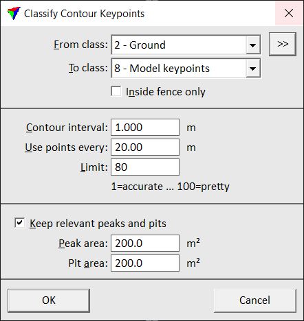
Contour keypoints
Contour keypoints routine classifies points for the production of contours. It works similar to the Model keypoints routine but produces a keypoint model which is suited for creating smooth, cartographic contour lines for map production.
If contours are derived from the original ground points, they are very accurate, detailed, and mathematically correct but less suited for being used for representation purposes. Small details in contour lines are caused by ground points close to contour line locations. Therefore, contour keypoints do not include points that are close to these locations.
The volumetric difference between a contour keypoint model and the model created from the original ground points is controlled by the Limit value for contour keypoints classification. The value determines how much the contours derived from the keypoints are smoothed. So higher the limit value, the smoother, nicer-looking the contours are but the less accurate the keypoint model is compared with the original ground model.
In addition to contour lines, the classification routine can also consider peaks and pits in the ground model. The values for Peak area and Pit area are used to define the minimum area that is enclosed by a contour line on top of hills or in depressions.

SETTING |
EFFECT |
|---|---|
From class |
Source class(es). |
|
Opens the Select classes dialog which contains the list of active classes in TerraScan. You can select multiple source classes from the list that are then used in the From class field. |
To class |
Target class. |
Inside fence only |
If on, points inside a fence or selected polygon(s) are classified. |
Contour interval |
Minimum interval planned for producing contours. |
Use points every |
Minimum point density of contour keypoints. In areas of completely flat ground, there is a keypoint at approximately the given distance. |
Limit |
Determines the accuracy of the contour keypoint model and thus, the smoothness of the resulting contours. |
Keep relevant peaks and pits |
If on, areas on top of hills and in depressions are considered in the model. |
Peak area |
Minimum size of a peak area enclosed by a contour line. |
Pit area |
Minimum size of a pit area enclosed by a contour line. |
