

TerraModeler User Guide
Import / XYZ text file
Xyz text file command in used to create a new surface model or to add points to an existing model from a text file. The text file stores at least the easting, northing, and elevation coordinates for each point of the model.
TerraModeler requires that one row in a text file represents one point. The coordinates have to be stored in fields separated by white space, comma, or semicolon. The text file may have additional fields, such as a point number, code, a text string, pen up field, or any other fields that can be ignored for the import.
To import points from a text file
1. Select Xyz text file command from the File / Import pulldown menu.
This opens the Import Xyz text file dialog, a standard dialog for opening files.
2. Locate the text file that stores the surface model points.
This opens the File Format for Import dialog:
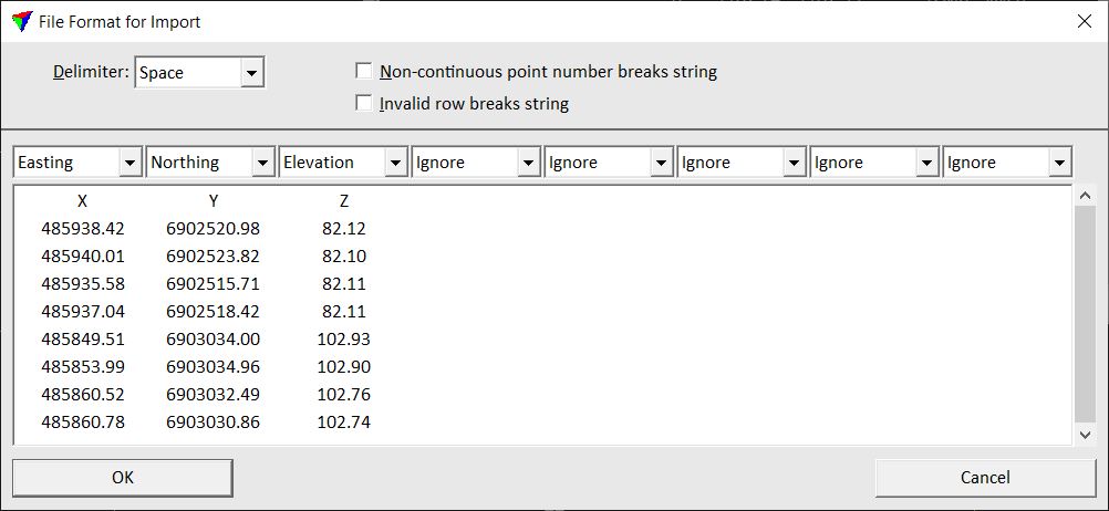
TerraModeler reads the first 25 rows from the text file and displays them in the dialog. The Delimiter is detected automatically.
3. Check the Delimiter and select the fields where E, N, and Z coordinates are stored.
4. If required, define additional fields and settings.
5. Click OK.
This opens the Point Usage dialog:
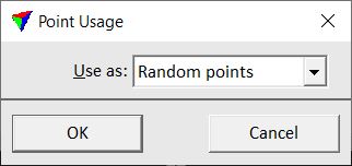
6. Define whether to use the points as Random points or as Breakline points.
7. Click OK.
This opens the Triangulate surface dialog. Follow the common steps for Creating a surface model.
A new surface model is created from the Xyz text file or the points are added to an existing surface model.
Setting |
Effect |
|---|---|
Delimiter |
Character that separates the fields in a line of one point from each other: Space, Comma, or Semicolon. |
Non-continuous point number breaks string |
If on, breaklines are split into separate chains if the point number increment is bigger than 1. |
Invalid row breaks the string |
If on, breaklines are split into separate chains if there is an empty or invalid line in the input text file. |
Attributes for fields in the text file |
Attribute that is stored for a point in a specific field: •Ignore - the field is ignored during import. •E, N, Z - easting, northing, elevation coordinates. •Code - text string. Defines, for example, the type of a breakline element. •Number - point number. •String - chain number. Defines, for example, continuous breakline elements. •Pen up - marks the end of a chain if it is not 0. |