

TerraMatch User Guide
Apply Correction
 Apply Correction tool applies known correction values to a data set. You can type in the correction values manually or they can be loaded from a TerraMatch corrections file saved by the following tools:
The tool allows to apply corrections to several types of data, such as laser data, tie lines, trajectories, and image lists in TerraPhoto.
In the process of applying corrections, the software interpolates values between observation locations, such as tie lines, relative to the travel distance. This method is more accurate than interpolation relative to time, especially for ground-based mobile scanning data sets where stops may occur.
General procedure for applying corrections:
1. Select the Apply Correction tool.
This opens the Apply corrections dialog:
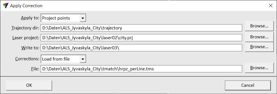
2. Define settings and click OK.
This opens subsequent dialogs where you can enter or verify the correction values to apply.
3. Click OK in order to start the process.
A report window displays the results of the process. The report is written during the process, if fluctuating corrections are applied to project points.
Setting |
Effect |
|---|---|
Apply to |
Data set to correct: •Project points - all blocks referenced by a given project file. (not UAV) •Loaded points - points loaded into TerraScan. •Tie line file - tie lines in a file saved on a hard disk. •Loaded tie lines - active tie lines in TerraMatch. •Loaded image list - active image list in TerraPhoto. •Trajectories - active trajectories in TerraScan. |
Laser project |
TerraScan project file to apply corrections to. This is only active if Apply to is set to Project points. |
Write to |
Directory into which to write the modified block binary files or the modified trajectory files. This is only active if Apply to is set to Project points or Trajectories. |
Trajectory dir |
Directory containing TerraScan trajectory files. |
Corrections |
Source of correction values: •Enter manually - corrections values are typed manually. •Load from file - reads correction values from a TerraMatch corrections file. |
File |
File containing correction values. This is only active if Corrections is set to Load from file. |
Correct |
Type of correction to apply: •Whole data set - one value to apply to the whole data set. •Individual lines - separate correction values for each strip. This is only active if Corrections is set to Enter manually. |
Key-in command syntax for Apply correction:
Example: