Fields
Fields command lets you select which attributes are displayed in the TerraScan window if point are loaded in TerraScan. The list of loaded points is only visible if the window is displayed as Medium dialog, Large dialog, or Wide dialog.
To select visible fields:
1. Select Fields command from the View pulldown menu.
This opens the View Fields dialog:
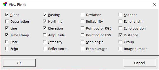
2. Select fields you want to see in the list of loaded points and click OK.
field name |
description |
|---|---|
Class |
Number of the point class. Mandatory attribute in TerraScan, must be unique. |
Description |
Description or name of the point class. Defined in the Point classes dialog. |
Line |
Line number. May refer to the flight line, drive path or scan number in ALS, MLS or static TLS point clouds. |
Time stamp |
Point of time when a laser point was captured. Expressed in seconds. |
Date |
Date of data capture. This is derived from the time stamp of a point, if the time stamp format is GPS standard time or GPS time. If the time stamp format used to calculate the date differs from the format specified in project information, the dates are highlighted with red font. |
Echo |
Return signal type. TerraScan distinguishes four return types: Only, First (of many), Intermediate, Last (of many). |
Easting | Northing | Elevation |
XYZ coordinates of points. Mandatory attribute in TerraScan. |
Amplitude |
Riegl Extra Bytes attribute: Amplitude. |
Intensity |
Reflectance value or strength of the return signal. Represents the reflectivity of the surface that was scanned. |
Reflectance |
Riegl Extra Bytes attribute: Reflectance. |
Deviation |
Riegl Extra Bytes attribute: Pulse shape deviation. |
Reliability |
Agisoft value: Confidence. |
Point color RGB |
Color of a point expressed in channels of the Red Green Blue color model. Uses 24-bit color values ranging from 0 to 65535. Color can be extracted from images or assigned using different methods. |
Point color HSV |
Color of a point expressed in values of the Hue Saturation Value color model. |
Scan angle |
Angle of a scan signal off from vertical. |
Echo number |
Number of return out of all returns from a scanner signal. |
Scanner |
Number of a scanner. Essential for differentiating data of different scanners in multiple-scanner systems. Assigned when a point cloud is loaded or imported into TerraScan. |
Echo length |
Relative length of a return signal compared to a typical return from a hard surface. Can be derived from waveform information in TerraScan (full version) or from Riegl Extra Byte attribute Pulse width. |
Echo position |
Difference in position of a peak of a return signal compared to a typical return from a hard surface. Can be derived from waveform information in TerraScan (full version). |
Distance |
Distance value of a point. Different computation methods. |
Group |
Group number assigned to a point. |
Image number |
Image number assigned to a point when color values are extracted from raw images. |