

TerraScan User Guide
Macro actions
Not Lite
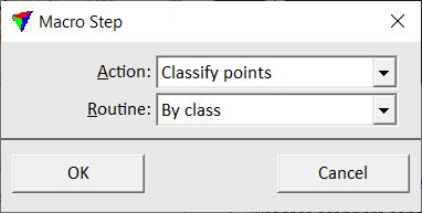
When you click on the Add button in the Macro dialog, the Macro Step dialog opens:
The Action field includes a list of all available macro actions. Depending to the selected action, another dialog may open when OK is clicked or the dialog may be expanded when the action is selected. The settings for the selected macro action are then defined in the next or expanded dialog.
An overview of macro actions is given in the table below. There is a corresponding tool or menu command for many of the macro actions. The following Sections explain only the settings and parameters that are specific for the macro actions. Otherwise, there is a link to the description of the corresponding tool or command.
TO |
USE ACTION |
|---|---|
Apply a classification routine for single points |
|
Apply a classification routine for groups |
|
Assign groups to laser points |
|
Fix groups along block boundaries |
|
Clear group numbers of selected classes |
|
Copy the group attribute from the closest neighbor point |
|
Split groups by class |
|
Draw polygons around point groups |
|
Detect paint markings from point cloud data |
|
Detect poles from point cloud data |
|
Detect overhead wires from point cloud data |
|
Create 3D models of buildings |
|
Call an Addon function |
|
Adjust misalignment angles |
|
Apply a TerraMatch corrections file to laser data |
|
Assign a color to laser points |
|
Create a surface model in TerraModeler |
|
Add a comment line to a macro |
|
Compute normal vectors for laser points |
|
Compute parameters of road cross sections |
|
Compute slopes on road surfaces |
|
Convert time stamps of laser data |
|
Cut off points from long range measurements |
|
Cut off points from overlapping lines |
|
Assign line number from trajectories to laser points |
|
Delete points of certain class(es) |
|
Delete points of certain line(s) |
|
Execute a Windows command |
|
Export a lattice model |
|
Extract additional points from waveform information |
|
Fix the elevation of points |
|
Execute a key-in command |
|
Adjust color values of points |
|
Modify line numbers of points |
|
Save points into new files |
|
Save points into new files separated by line |
|
Save points into the original file |
|
Manipulate intensity values |
|
Run a tie line search in TerraMatch |
|
Smooth the elevation of points |
|
Sort points by time stamps or coordinate values |
|
Thin points to a lower density |
|
Apply a transformation to the points |
|
Update the display of a CAD file view |
|
Create a section points data set |
|
Write points into CAD file |
Each macro action returns a value that indicates whether a process was successful or failed. The return value can be the amount of points that has been effected by the macro action or another value specifying the result of the macro action. The return value is displayed in the Macro execution window if a macro was executed in TerraScan or it is written in the report text file if the macro was executed in TerraBatch. If a processing step failed, the line in the Macro execution window appears in red color and the return value is usually -1.