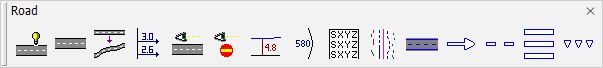
Road toolbox
The tools in the Road toolbox are used to place breaklines of roads, to analyze the slopes on the road surface and sight conditions, to place labels for curvatures, to write elevation values along an alignment, and to start the fit geometry components module.
TO |
USE TOOL |
|
|---|---|---|
Find road breaklines automatically |
|
|
Find multiple breaklines along a road |
|
|
Import breaklines back to world coordinate system |
|
|
Draw slope arrows perpendicular and along alignment |
|
|
Draw sight distance values along road |
|
|
Display locations with line of sight to a sign polygon |
|
|
Label smallest distance point inside polygons |
|
|
Label alignment curvature at regular intervals |
|
|
Write alignment elevations at regular steps |
|
|
Mark elements close to a centerline element |
|
|
Digitize paint lines automatically from loaded points |
|
|
Place standard paint marking symbols manually |
|
|
Place paint lines manually |
|
|
Place crosswalk paint markings manually |
|
|
Place paint marking symbol rows manually |
|
|


