

TerraScan User Guide
Top surface
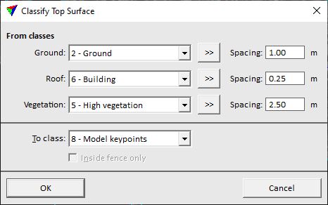
Top surface routine classifies points that form a common surface model in the point cloud. From up to three source class types, the highest points at each location are classified. The result is suitable, for example, to create true orthophotos without additional vector models.
SETTING |
EFFECT |
|---|---|
Ground |
Class(es) that contain points on the ground. |
Roof |
Class(es) that contain points on high planar objects, such as buildings or bridges. |
Vegetation |
Class(es) that contain points on high complex objects, such as vegetation. |
|
Opens the Select classes dialog which contains the list of active classes in TerraScan. You can select multiple source classes from the list that are then used in the Ground, Roof or Vegetation fields. |
Spacing |
Determines the point density in the target class for the different source class types. |
To class |
Target class. |
Inside fence only |
If on, points inside a fence or selected polygon(s) are classified. |
